AI and Aerial Scans Reveal 303 Hidden Nazca Geoglyphs
Researchers from Yamagata University used artificial intelligence and high-resolution aerial scans to identify 303 previously unknown geoglyphs in Peru's Nazca Desert.
What Happened
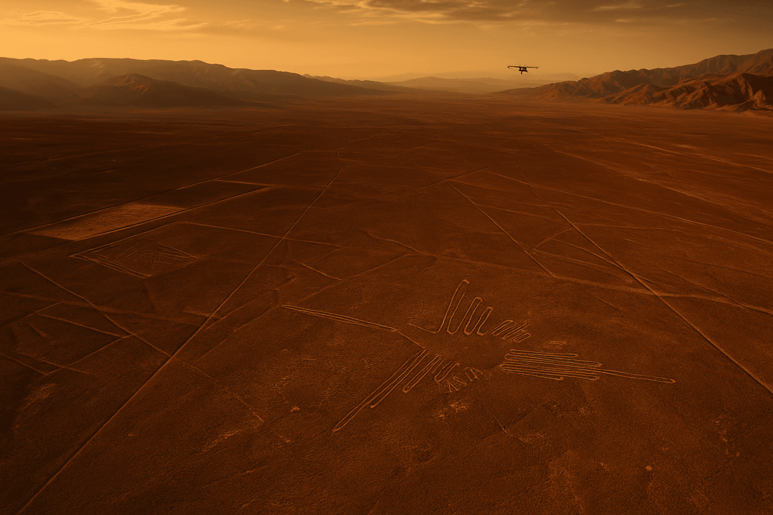
Researchers from Yamagata University in Japan have identified 303 previously undocumented geoglyphs in Peru's Nazca Desert, using a combination of artificial intelligence and high-resolution aerial imaging technology. The discovery significantly expands the known catalogue of ancient figures at one of the world's most studied archaeological sites.
How the Research Was Conducted
The team applied AI-assisted image analysis to aerial and high-resolution scan data collected over the Nazca plateau, a region in southern Peru spanning roughly 450 square kilometres. Traditional survey methods at the site rely heavily on manual visual inspection of aerial photography, a process that is time-consuming and prone to missing faint or partially eroded markings.
The AI system was trained to detect patterns consistent with known geoglyphs, allowing researchers to process large volumes of scan data at a scale and speed not achievable through conventional fieldwork alone. The 303 newly identified figures were subsequently verified through ground surveys conducted by the research team.
Background
The Nazca Lines are a collection of ancient geoglyphs etched into the surface of the Nazca Desert, created by the Nazca culture between approximately 500 BCE and 500 CE. The site was designated a UNESCO World Heritage Site in 1994 and has been the subject of continuous archaeological research for decades.
Yamagata University has maintained an active research presence at the Nazca site for a number of years. A previous collaborative study involving the university and IBM, published in 2019, used AI to identify a smaller set of previously unrecorded geoglyphs, including a humanoid figure. That earlier project demonstrated the potential of machine-learning tools for archaeological survey work at the site, and the current research represents a substantial expansion of that methodology.
The figures documented in prior surveys include large animals, plants, and geometric shapes, some stretching several hundred metres in length. Many of the newly identified geoglyphs are smaller in scale, which researchers have indicated contributes to their having gone undetected under traditional survey conditions.
What the Discovery Includes
The 303 newly catalogued geoglyphs include a range of forms. Researchers identified figures depicting humans, animals, and other shapes among the newly recorded markings. Specific details on the breakdown of figure types and their precise locations within the plateau were reported as part of the study findings.
The total number of known geoglyphs at the Nazca site now stands considerably higher following this addition, though the complete updated count across all documented surveys was not specified in the available wire report.
The Role of AI in Archaeological Survey
The Yamagata University project is among a growing number of archaeological studies to employ AI-assisted detection methods for field identification tasks. The approach addresses a core logistical challenge at large, remote sites: the gap between the volume of scan data that can be collected and the capacity of research teams to manually review it.
By automating the initial detection phase, the AI system allowed researchers to flag candidate sites for human verification rather than relying on human analysts to scan raw imagery in full. The method does not replace on-the-ground archaeological assessment but reduces the time required to identify areas warranting closer inspection.
What Comes Next
The Yamagata University team is expected to continue its survey work at the Nazca site, with further analysis of the newly identified geoglyphs planned to establish their age, cultural context, and relationship to previously documented figures.
Get our editors' take on what it all means. Read the Editor's Blog →